How Virtual Landscape Design Works: Tools, Process & Site Analysis Explained

In today's interconnected world, geographical boundaries no longer limit exceptional virtual landscape design. At Williston Horticulture & Design, we've honed a remote landscape design process that allows us to collaborate with clients anywhere, transforming outdoor spaces with the same precision, ecological insight, and artistic vision as our on-site projects. Our secret? A powerful stack of complementary satellite and mapping tools that provide an almost on-site level understanding of your property, even before we set foot on it.
How Remote Intelligence Powers Our Virtual Landscape Design Process
As a remote landscape designer, stacking a few complementary satellite and mapping tools gives us an almost on-site level understanding of a property. Each one fills a different gap that aerial imagery alone can’t. Here are the most valuable tools that we use in Virtual Landscape Design:
AutoCAD: The Foundation of Precision Base Mapping
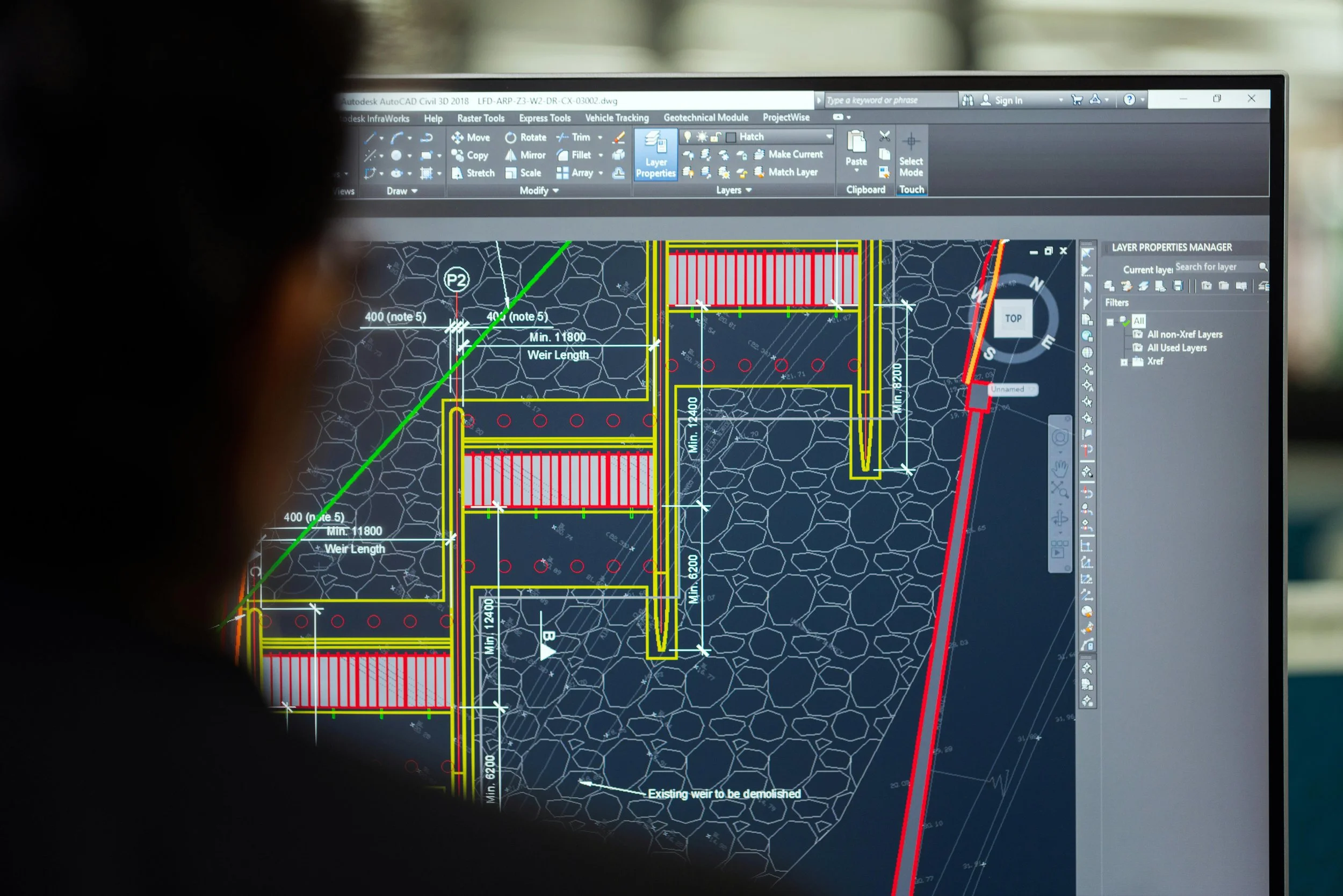
Before any creative design begins, a precise base map is essential. We utilize AutoCAD for all our base mapping. This industry-standard software allows us to create accurate, scalable drawings of your property, incorporating all existing features, structures, and utilities. This foundational layer ensures that every design decision is grounded in precise measurements and spatial relationships, providing a blueprint for both conceptual development and eventual installation.
Google Earth Pro: Your Property from Above
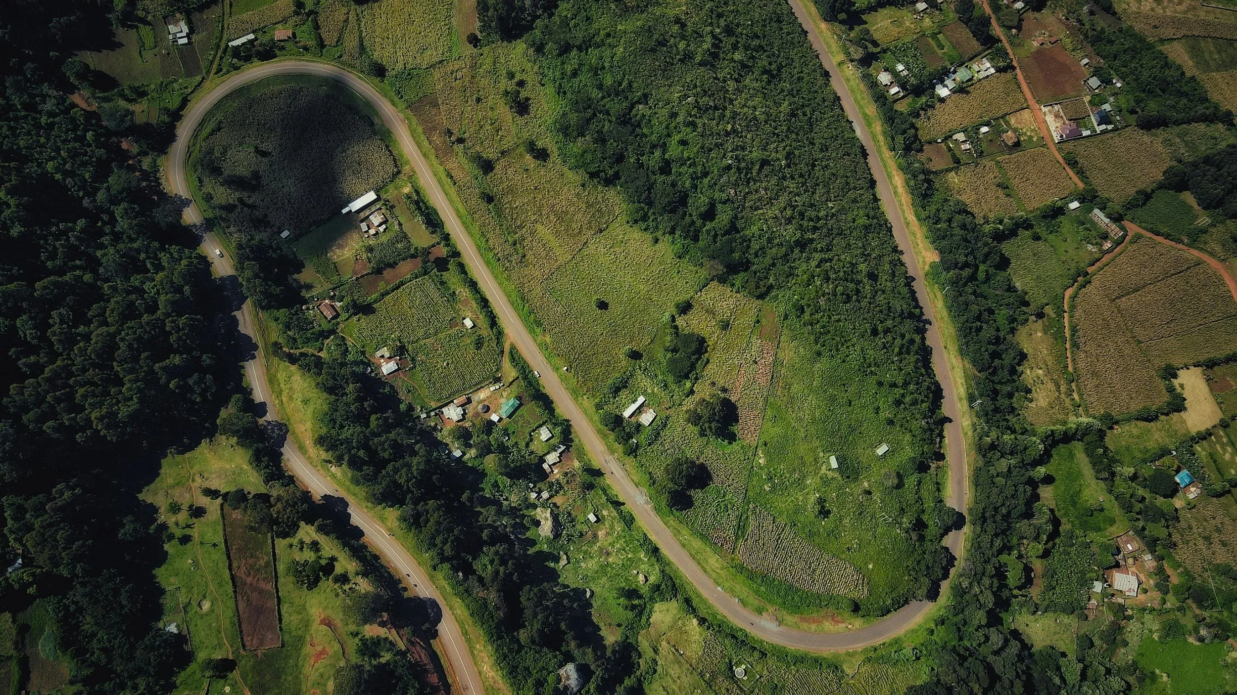
For initial site reconnaissance, Google Earth Pro is an invaluable resource. It gives us an understanding of a property before ever stepping on site. As a landscape designer, we use it to:
Collect aerial imagery: Providing a bird's-eye view of your property and its surroundings.
Measure distances and areas: Essential for understanding the scale of your project.
Study topography and slope: Identifying natural contours and potential drainage issues.
Understand how the site relates to its surroundings: Like neighboring properties, tree cover, water flow patterns, and access points. It’s especially useful for building a base map and identifying opportunities or constraints early in the design process.
This comprehensive aerial perspective allows us to grasp the macro-level context of your landscape, informing our initial design concepts.
Web Soil Survey: Unearthing Your Property's Potential
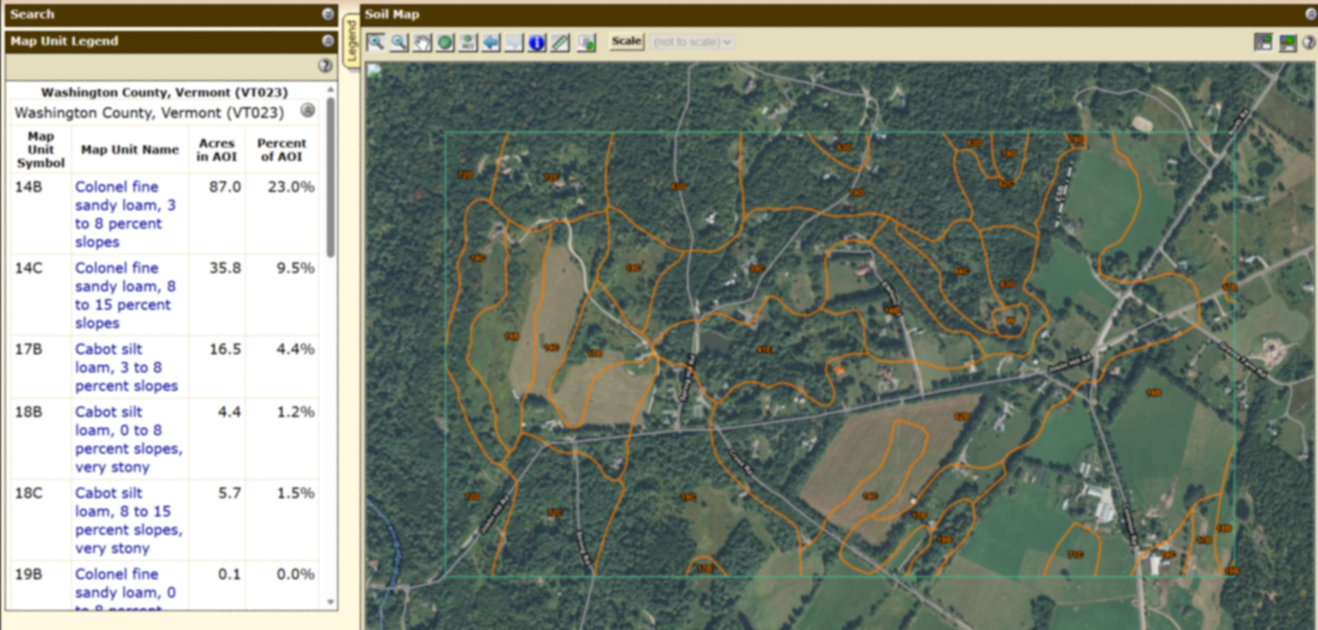
Understanding what lies beneath the surface is just as crucial as what's on top. Web Soil Survey provides site-specific soil data that helps us to design with the land rather than against it. We use this tool to:
Identify soil types: From sandy loams to heavy clays, knowing your soil type is fundamental.
Determine drainage capacity: Crucial for plant health and managing stormwater.
Assess depth, texture, and limitations: Such as compaction or seasonal wetness.
This data reveals suitability for planting, septic systems, and construction—helping us make informed decisions about plant selection, grading, and long-term landscape performance. It's a cornerstone of our "right plant, right place" philosophy, ensuring plants are matched to their ideal subterranean environment.
USGS & SunCalc: The Shape of the Land and the Dance of Light
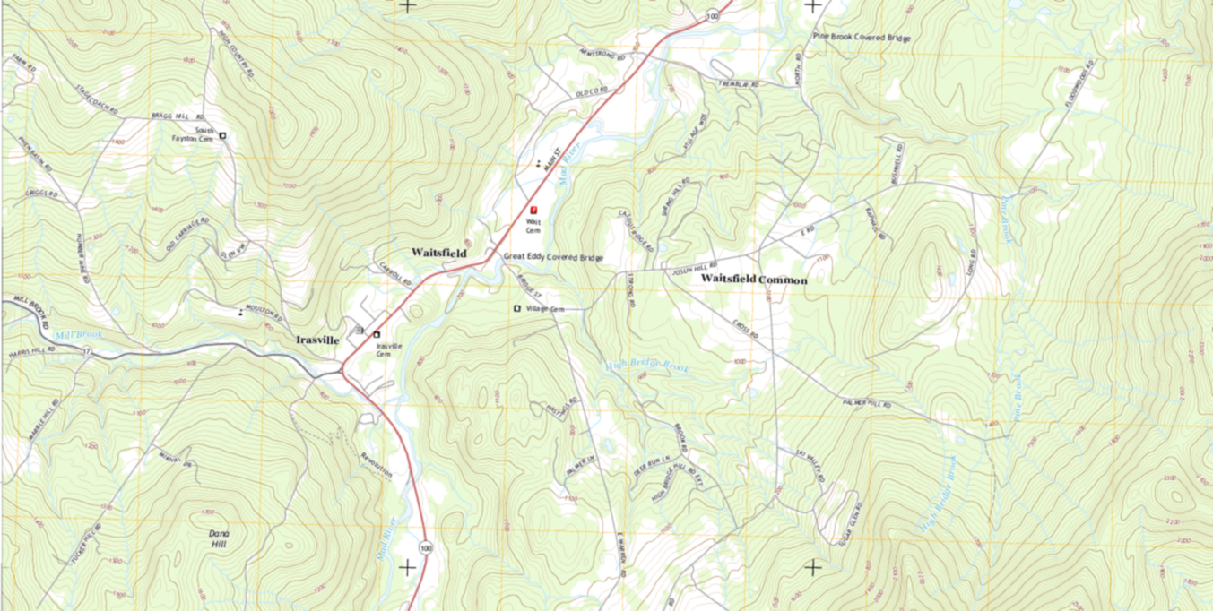
To truly understand a site, we need to analyze both its physical form and its interaction with the sun. USGS (United States Geological Survey) data and SunCalc work in tandem to provide this critical insight:
USGS data: Reveals elevation, slope, and drainage patterns. This helps us understand the natural flow of water across your property and identify areas that might be prone to erosion or require specific grading solutions.
SunCalc: Shows precise sun angles, seasonal light exposure, and shadow movement throughout the year. This is vital for optimizing plant placement, designing comfortable outdoor living spaces, and understanding how light will interact with architectural elements.
Together, these tools help us to strategically place gardens, outdoor living spaces, and plantings in locations that respond to both terrain and sunlight, resulting in more functional, comfortable, and ecologically responsive designs.
The Williston H&D Difference: Expertise, Nationally
Our commitment to virtual landscape design means that no matter where your property is located, you have access to Williston Horticulture & Design's expertise. By meticulously gathering and analyzing remote data with these advanced tools, we can develop a deep understanding of your site's unique characteristics, allowing us to craft bespoke landscape solutions that are beautiful, sustainable, and perfectly suited to your vision. Our virtual process is efficient, transparent, and designed to bring your dream landscape to life on a national level.
Ready to explore the possibilities of virtual landscape design for your property? Reach out to Williston Horticulture & Design to start the conversation.